
I spent most weekends of my youth on the road to and from my grandparents’ house in Nicholasville, so much so that I could follow it in my mind, specifically after exiting I-64 at Frankfort/Versailles. Passing through Woodford Co along that stretch of horse farms leading into downtown Versailles is picturesque. In my adolescent years, I resented having to go but now find myself full circle longing to spend more time in and around the places of my parents’ youth.
Both of my parents were born at home in Jessamine County – Dad, at the Mathews home place, Harrodsburg Road, and Mom, in Little Hickman, near Lock 8 of the Kentucky River. Eventually, they were neighbors on Richmond Road near downtown Nicholasville and as the story goes, he gave her a ride home from work one afternoon.

In 1798, the town of Nicholasville was laid out and named for General Nicholas, while Jessamine Co was created from part of Fayette Co and named for Jessamine Creek. Historical accounts note in 1774 surveyor James Douglass discovered a creek which he named for his eldest daughter Jessamine. Other accounts note the county was named by Col. John Price for the prevalence of Jessamine flowers, also known as jasmine. And, a bit of oral tradition describes a tragic account that Jessamine Douglass, daughter of James Douglass, was sitting alone overlooking a creek when she was attacked by an Indian. There are competing beliefs for the validity of this story and some who debunk it are adamant against its truth. As best I can tell, there is nothing definitive discovered to date but that is somewhat inherent in oral traditions.
Based on artifacts I’ve found, there was a landowner early in the settling of the county named James Douglass. A survey map with notations of Daniel Boone indicates as of August 17, 1784, Douglass owned property adjacent to present-day US-68 (Harrodsburg Road). Part of this property was later acquired by my great-great-grandfather Pleasant Cook and stayed in the family until the late 1960s. It was the home place for my father, his siblings and parents.
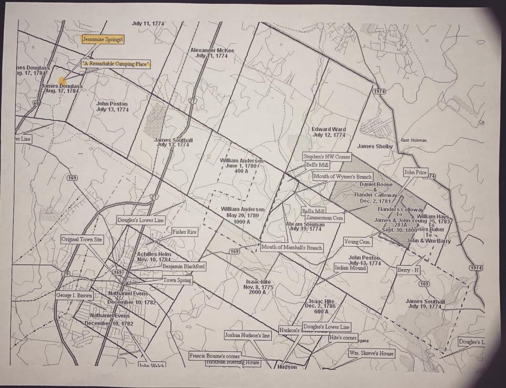
An interesting notation on the survey map pinpoints the springs of Jessamine Creek with “A Remarkable Camping Place” which leaves me wondering – Did Daniel Boone camp at that spot?
Credits to: Jessamine County Historical Society map image and the work of countless researchers before me, and to my cousin Jeff Mathews for sharing family artifacts that kickstarted my obsession.

I’ve known for years of your interest in your family history and I congratulate you on your blog and ability to make us want to know more. Thank you!
LikeLiked by 2 people
Thank you, Joyce!
LikeLike